
Laser scanning of industrial plant
Detection of three-dimensional models of objects
In modern engineering, the general meaning of laser scanning is the controlled deflection of laser beams, visible or invisible. Within the field of 3D object scanning, laser scanning combines controlled steering of laser beams with a laser rangefinder. Our Company is able to provide complete coverage by combining the traditional methods with the topographic laser scanner system, with the aim of restoring products and satisfactory in terms of the amount of information and the high degree of detail of the information collected in the country side. The digital model obtained, corresponding with extreme precision to the reality, it will be geo-referenced and integrated in the CAD system with the same coordinate system. The laser scanner technology, is today the most innovative, rapid and extremely accurate, to perform measurements of objects and surfaces of any complexity and size. The individual scans, reconnect to each other in space by means of unique points in common between them, it allows to obtain a digital model consists of millions of 3D points, corresponding to the reality and having milimetric-precision.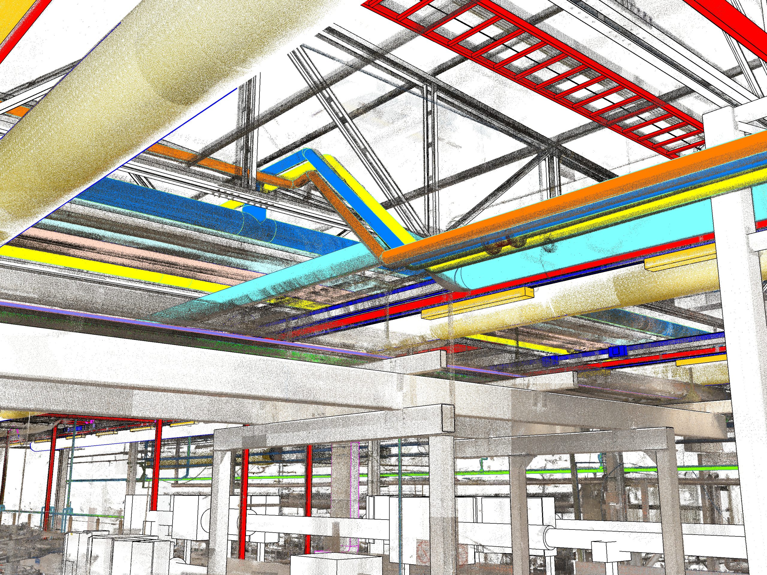
Laser scanning solution for industry
Architectural survey
Geometric-topographic measurements
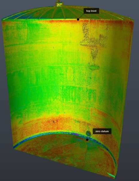
For architectural survey (geometric-topographic) we mean the measurements made for the acquisition of data for the graphic representation of buildings, parts of buildings and the environment that surrounds them. We are able to perform architectural surveys with laser scanners for buildings of any complexity and extension, residential, commercial, industrial, directional, historical bound. The drafting of the project is usually carried out in an Autocad environment, Revit modeling and 3dmax studio, Revit to BIM (or other on request). The detailed survey is performed with laser scan station, the quality of the data is ensured by the digital compensator. The cloud of 3d points, will be built through the full registration of all movements (Scanword) that will connect all the internal environments for each floor with the outside, allowing to contextualize the compendium with the external road network and with neighboring buildings in adherence or neighbors, including coverage. The complete ModelSpace will be made available to be completed by the client in Autocad or dwg compatible.
Photogrammetric survey
Metric determination of shape and position of objects
We offer photogrammetry services that include geometric analysis, analysis of materials and surfaces, generation of 3D models and bi-dimensional elaborations. The photogrammetry is a technique that allows to determine metrically shape and position of objects, starting from at least two distinct frames, this technique is applicable in many areas, from architectural relief to topographic, using mainly aerial photogrammetry. Thanks to the use of air carriers, such as SAPR devices (drones), we can reach otherwise inaccessible areas, objects of great territorial extension and we can see complex objects from a new point of view. The first result of the photogrammetric survey is the point cloud, which can be integrated with other 3D clouds generated by terrestrial laser scanners. The survey obtained can therefore be georeferenced with, for example, GPS. Thanks to specific software we process the acquired frames and the point cloud, obtaining 3D meshes, soil models (DTM, DEM, DSM), etc. that guarantee the best support for the analysis and representation of quarries, roofs, etc.
Topographic survey
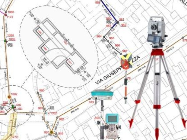
Topography is the study of the shape and features of the surface of the Earth and other observable astronomical objects including planets, moons, and asteroids. The topography of an area could refer to the surface shapes and features themselves, or a description (especially their depiction in maps). We are able to manage and develop topography projects with the use of the most modern hardware equipment (drones, etc.) and related specialized software, starting from the initial survey using traditional methods, GPS, or laser scan. The main phases of the project are usually the following:Georadar
Ground-penetrating radar (GPR) is a geophysical method that uses radar pulses to image the subsurface. This non-destructive method uses electromagnetic radiation in the microwave band (UHF/VHF frequencies) of the radio spectrum and detects the reflected signals from subsurface structures. GPR can have applications in a variety of media, including rock, soil, ice, fresh water, pavements and structures. Our structure, composed of highly qualified technicians is able to provide the following activities: